|
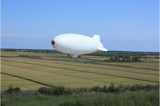
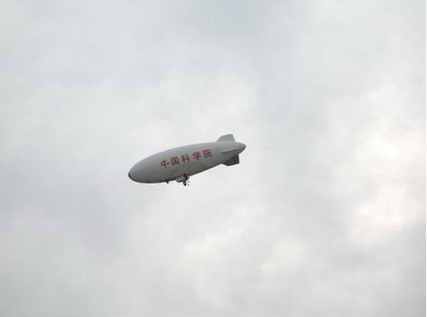
On September 3rd to 12th ,with the technological support of AoFeiya Technology Co. Ltd, Ecology Remote Sense team and Wetland Ecology Management team from NEIGAE, successfully conducted a survey in Sanjiang Plain, Honghe Wetlands National Nature Reserve, based on detailed remote sensing survey of wetland vegetation using Remote Control Airship and spatial tests of wetlands climate, which is the first time obtaining the detailed spatial distribution of information on vegetation communities in the Sanjiang Plain wetlands and the wetlands - land marginal zone climate-dimensional vertical profile of temperature and humidity profile data.
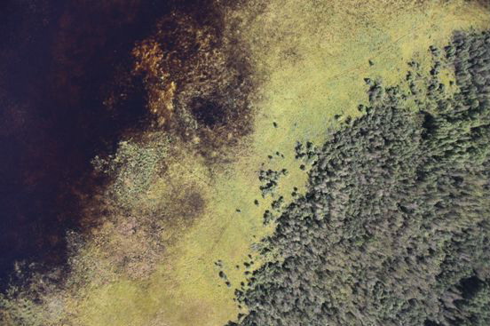
The test uses automatic airship supplied with High spatial resolution digital camera and location of the attitude measuring device, continuous shooting routes above Honghe Wetland National Nature Reserve to capture the regional distribution of wetland vegetation, flying height of 100 meters, 200 meters, 300 meters and 500 meters, obtained with different spatial resolution of wetland vegetation communities in remote sensing image data. Meanwhile, the remote control airship mounted a series of temperature and humidity sensors, through numerous flights crossing of wetlands - the edge of cultivated land, obtain the wetland landscape of regional two-dimensional vertical profile of temperature and humidity data. The information obtained for the distribution of wetland vegetation communities and wetlands to climate spatial variation study has provided first-hand information and a sound data base for biodiversity conservation, cold-wet effects of ecological functions of wetlands, which helps NEIGAE to obtain new information to conduct high-quality wetlands for future scientific research and protection of wetland resources.
This experiment is an important direction project of Chinese Academy of Sciences titled "Landscape ecological functions of wetlands conversion and evolution of spatial scale-driven mechanism (KZCX2-YW-425)" ,During the experiment Honghe farms, Honghe Wetland National Nature Reserve, and Sanjiang Plain wetlands ecological Experiment Station,CAS, had provided great support. The experiment has also attracted a strong local media attention, which helps to raise awareness of local people and promote wetland conservation. In addition, the team also shot for Marsh Wetland experimental farm field and Honghe farm. It provided a scientific basis for the planning and management of swamp wetland design and optimization in Honghe farm.

|
